
As many of you may know, last month Colorado was hit hard by a series of heavy rains over several days that caused massive flooding all the way from the eastern slopes of the mountains to the Nebraska border. The mountain town I grew up in, Estes Park, was pretty much cut off from the outside world for several days and still remains difficult to access with two of the major highways washed away and in need of serious repairs. Needless to say, this flooding has had severe economic impact on many of these communities, as well as the loss of life and property for many families.
As a photographer I felt the need to document some of what was going on. I wanted to write this blog post to share with you some of the views I had of the catastrophic event. This handful of images will all be focused on the flooding that occurred around the Greeley area, where I live. I will let the photos do most of the talking, but will also explain some things I feel necessary in the image captions. Please click on the images for larger views.

It was heartbreaking to see the damage to people's personal property, even more so as some homeowners were showing up to their homes for the first time after the initial flood crest while I was there. In general, many of the people I came across seemed in surprisingly good spirits for the circumstances. People can be quite strong through the worst of events, but still I can't imagine the amount of work that lies ahead for those who lived near the river.


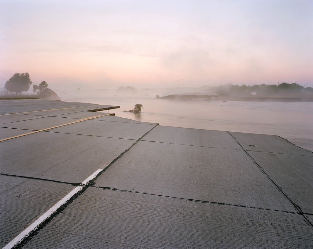
Nearly all the roads that cross the South Platte River were completely destroyed, as you can see in these next few photos taken north and east of Kersey, Colorado.


This really was an unbelievable event to photograph. While it is terrible to think of the damage and loss of property, in some ways I could only hope that I could bring a sense of beauty into a few of these images. Standing in the middle of a major highway that was completely split in two and photographing a foggy sunrise is an experience I will never forget, nor is it something I would have ever done on a normal day. I will leave this post with one final image, taken three weeks after the initial flooding. A small section of low land along the Big Thompson River east of Milliken has continued to hold water long after most areas, and made for a perfect reflection of these cottonwood trees during a classic explosive October sunrise.

Please follow me on Facebook to find out about my latest blog releases like this one.